To give you a feel for the scope and distance of the adventure to come, here is our current Circumnavigation ITINERARY, along with a few details and comments.
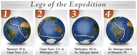
:: Circumnavigation of the Globe (Planned Itinerary – updated 9.25.13)
Commencing OCTOBER 1, 2013 in NEWPORT RI and returning to Newport, RI approx. JUNE 1, 2014Â after completing a 30,000 mile “singlehanded” circumnavigation of the globe!
The voyage is divided below into Four Legs:
LEG ONE – Newport, RI to Cape Town, South Africa (39 Days – 7200 Miles)
LEG TWO – Cape Town, South Africa to Wellington, New Zealand (36 Days – 6931 Miles)
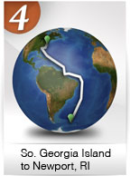
LEG THREE – Wellington, NZ to So. Georgia Island, South Atlantic (27 Days – 5400 Miles)
LEG FOUR – So. Georgia Island back to Newport, RI (40 Days – 7100 Miles)
And at any point along the way, if YOU have any thoughts, suggestions, advice, questions or such, please feel free to email us at info@bodacousdreamexpeditions.com!
So, let’s take a look!
:::::::::::::::::::::::::::::::::::::::::::::::::::::::::::::::::::::::::::::::::::::::::::::::::::::::::::::::::::::::::::::::::::::::::::::::::
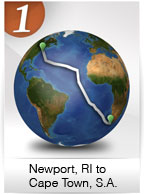 LEG ONE • Newport, RI to Cape Town, South Africa (39 Days – 7200 Miles)
#1) Leaving NEWPORT, RHODE ISLAND
Coordinates: 41°28’37.58″N, 71°20’2.32″W – Google Maps
Download .kmz file & click to open in Google Earth (get plug-in)
Course from Start: Leave historic Newport, Rhode Island on a southerly course towards the equator, and then eastward.
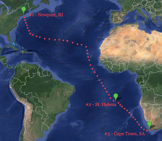
#2) Commence onward to  ST. HELENA ISLAND (in the middle of the Southern Atlantic)
Coordinates: 15°55’4.42″S, 5°43’42.36″W – Google Maps
Download .kmz file & click to open in Google Earth (get plug-in)
Length of sail:Â 5758 miles
Expected duration of sail: Approximately 30 Days
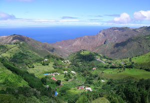
St. Helena
Goal: This remote and desolate island in the middle of the south Atlantic provides a unique opportunity to stop and explore. The island was uninhabited when it was discovered by the Portuguese in 1502. One of the most isolated islands in the world, it was for centuries an important stopover for ships sailing to Europe from Asia and South Africa. The British also used the island as a prison and place of exile. A major breeding site for seabirds, it has well-preserved coral systems and many endemic and non-endemic fish species.
#3) Commence onward to CAPE TOWN, SOUTH AFRICA
Coordinates: 33°54’10.41″S, 18°26’35.00″E – Google Maps
Download .kmz file & click to open in Google Earth (get plug-in)
Length of sail: 1700 miles
Expected duration of sail: Approximately 9 Days
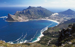
Cape Town
Goal: Visit whale habitat, various cultural areas and this historical maritime waypoint for world circumnavigators both modern day and historical. Cape Town is known as the “Tavern of the Seas.” With a population of 3.75 million, it is one of the most multicultural cities in the world, reflecting its role as a major destination for immigrants and expatriates to South Africa.
::::::::::::::::::::::::::::::::::::::::::::::::::::::::::::::::::::::::::::::::::::::::::::::::::::::::::::::::::::::::::::::::::::::::::::::::
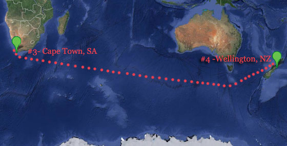
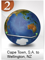 LEG TWO • Cape Town, SA to Wellington, New Zealand (36 Days – 6931 Miles)
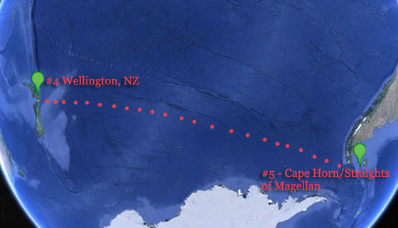
#4) Commence onward to WELLINGTON, NEW ZEALAND
Coordinates: 41°17’2.19″S, 174°48’44.57″E – Google Maps
Download .kmz file & click to open in Google Earth (get plug-in)
Length of sail:Â 6931 miles
Expected duration of sail:Â Approximately 36 Days
Goal: Wellington, NZ is on the southern tip of the North Island of New Zealand. It is also the birthplace of Bodacious Dream as she was launched there in December 2011. The plan is to visit many interesting natural sites around New Zealand. Almost half the world’s cetaceans (whales, porpoises and dolphins) have been reported in nearby waters. For example, endemic Hector’s dolphins (found nowhere else), rare beaked whales, New Zealand sea lions (found only in our southern waters), and the widely distributed New Zealand fur seals(keen.) Other seals that visit our shores occasionally, such as the southern elephant seal (ihupuku) and the leopard seal are to be found as well.
::::::::::::::::::::::::::::::::::::::::::::::::::::::::::::::::::::::::::::::::::::::::::::::::::::::::::::::::::::::::::::::::::::::::
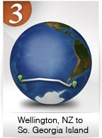 LEG THREE • Wellington, NZ to South Georgia Island (27 Days – 5400 Miles)
#5) Commence onward to CAPE HORN AND STRAIGHTS OF MAGELLAN
Coordinates: 55°43’2.15″S, 66° 6’59.07″W – Google Maps
Download .kmz file & click to open in Google Earth
Length of sail: 4200 miles
Expected duration of sail: Approximately 21 Days
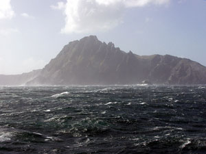
Cape Horn
Goal: Visit and cruise historic Cape Horn and Straights of Magellan. Cape Horn, loved and feared by seamen over the last four hundred years, is the southernmost headland of the Tierra del Fuego archipelago of southern Chile. For many years, before the Panama Canal opened in 1914, it was a major milestone on the clipper route, by which sailing ships carried trade around the world. However, the waters around the Cape are particularly hazardous, owing to strong winds, large waves, strong currents and icebergs; these dangers have made it notorious as a most dangerous place to sail.
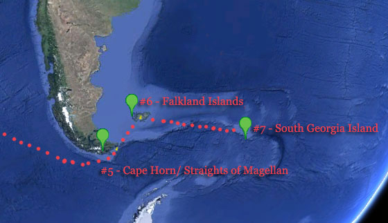
#6) Commence onward to the FALKLAND ISLANDS
Coordinates: 52°3’59.64″S, 59°55’18.73″W – Google Maps
Download .kmz file & click to open in Google Earth (get plug-in)
Length of sail: 400 miles
Expected duration of sail: Approximately 2 Days
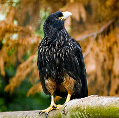
Striped Carcara
Goal: These interesting islands are just east of the southern tip of South America. The Falkland Islands are classified as part of the “mild” Antarctic zone. Land birds make up most of the Falklands’ avifauna, followed by seabirds; a total of 63 species breed on the islands, including 16 endemic species. The Falkland Islands are frequented by marine mammals such as the southern elephant seal and the South American fur seal. Offshore islands house the rare striated caracara.
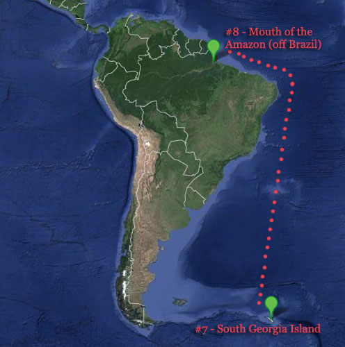
#7) Commence onward to SOUTH GEORGIA ISLAND
Coordinates: 54°13’1.47″S, 36°31’35.67″W – Google Maps
Download .kmz file & click to open in Google Earth (get plug-in)
Length of sail: 800 miles
Expected duration of sail: Approximately 4 Days
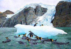
Goal: This historic location was the final rescue place of the Shackleton Expedition when they were trapped on Antarctica through the winter and traveled overland, built a small boat and sailed to South Georgia Island for rescue. This was an amazing story of human endurance. Shackleton is buried on South Georgia Island. PArts of the island are permanently covered in ice, it is a very biodiverse region. Â We’ll be seeing penguins, petrels, albatrosses, seals and whales.
::::::::::::::::::::::::::::::::::::::::::::::::::::::::::::::::::::::::::::::::::::::::::::::::::::::::::::::::::::::::::::::::::::::::::::::::
 LEG FOUR • South Georgia Island back to Newport, RI (40 Days – 7100 Miles)
#8) Commence onward to the MOUTH OF THE AMAZON RIVER  (off the coast of BRAZIL)
Coordinates: 0°35’13.68″N, 49°35’46.95″W – Google Maps
Download .kmz file & click to open in Google Earth (get plug-in)
Length of sail:Â Approximately: 14 Days
Expected duration of sail:Â 2700 miles
Goal: Explore the mouth of the largest river in the World and its effect on the ocean and species of animals that adapt to the mix of salt and fresh waters. The Amazon River carries more water than any other river in the world, and is responsible for about one-fifth (twenty percent) of the fresh water that flows into the world’s oceans. There are over 2,100 species of fish currently recognized in the Amazon Basin, with more being discovered every year.
#9) Commence onward to ANTIGUA, WEST INDIES
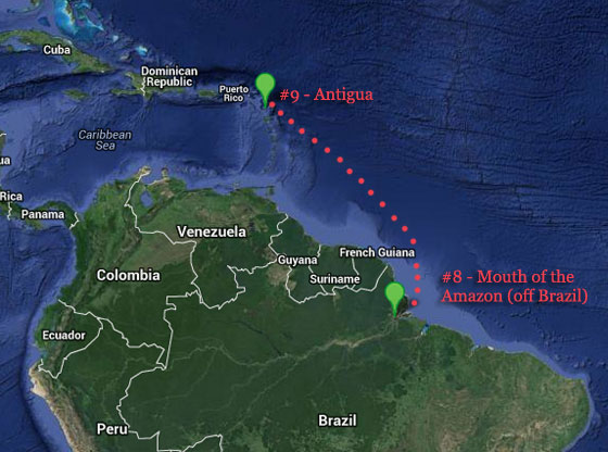
Coordinates: 17° 0’36.41″N, 61°47’1.13″W – Google Maps
Download .kmz file & click to open in Google Earth (get plug-in)
Length of sail: 5000 miles
Expected duration of sail: Approximately 30 Days
Goal: One of the great Caribbean Islands on the way back to the East Coast of the United States. Larger marine life such as turtles, stingrays, barracuda, jacks, permit, nurse sharks and morays are regularly seen in the waters around Antigua.
#10) Commence onward to CHARLESTON, SOUTH CAROLINA
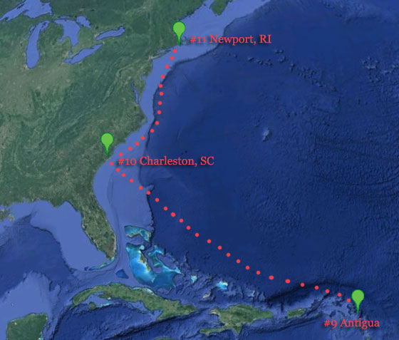
Coordinates: 32°47’22.83″N, 79°54’48.56″W – Google Maps
Download .kmz file & click to open in Google Earth (get plug-in)
Length of sail: 1400 miles
Expected duration of sail: Approximately 6 Days
Goal:Â A quick stop in Charleston, which has become a second home for Bodacious Dream as she has competed the past two years in the Atlantic Cup Race that starts in Charleston. We’ll be on the lookout for Lionfish, Amberjack, Sea Turtles, Barracuda, Sharks and Sunfish.
#11) Commence onward to completion of circumnavigation in NEWPORT, RI
Coordinates: 41°28’37.58″N, 71°20’2.32″W – Google Maps
Download .kmz file & click to open in Google Earth (get plug-in)
Length of sail: 700 miles
Expected duration of sail: Approximately 4 Days
:::::::::::::::::::::::::::::::::::::::::::::::::::::::::::::::::::::::::::::::::::::::::::::::::::::::::::::::::::::::::::::::::::::::::::::::
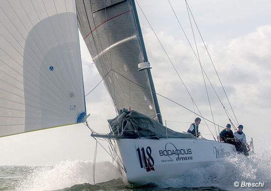 Bodacious Dream – A Class 40 Sailboat
 Skipper Dave Rearick.